Lyon Saint Exupery Airport (LYS)
City Orientation and Maps
(Lyon, France)
Lyon is a sprawling city and has become one of the largest in overall size in the whole of France, being second only to Paris. The city of Lyon resides in the south-eastern region of France, being especially close to Saint-Etienne to the south-west and Grenoble to the south-east.
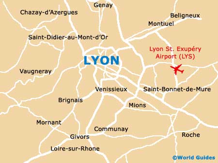
Located on the city's eastern outskirts, Lyon Saint Exupery Airport (LYS) is responsible for much of the city's wealth and status, transporting large numbers of visitors to the area each year. Many people arriving in Lyon choose to visit the coastal cities of Monaco and Nice, which can be reached in around four hours by car, while Marseille is also popular and slightly nearer, with a journey time of just over two and a half hours.
Lyon Saint Exupery Airport (LYS) Maps: Important City Districts
The city of Lyon boasts a good public transport network, including a modern and eco-friendly tram system. A new TGV train station has recently opened and can be found along the Grenoble autoroute, on the south-eastern side of Lyon, close to Saint Exupery Airport.
Lyon is divided into nine main districts, which are known in France as arrondissements. These include the Presqu'ile area, which encompasses both the 1er and 2e arrondissements, between the River Rhone and the River Saone. Other prominent areas include Vieux Lyon, the 5e arrondissement, located alongside the western bank of the River Saone and home to the La-Part-Dieu development.
France Map

Lyon Map


